Goubet al-Kharab: the gulf of Demons
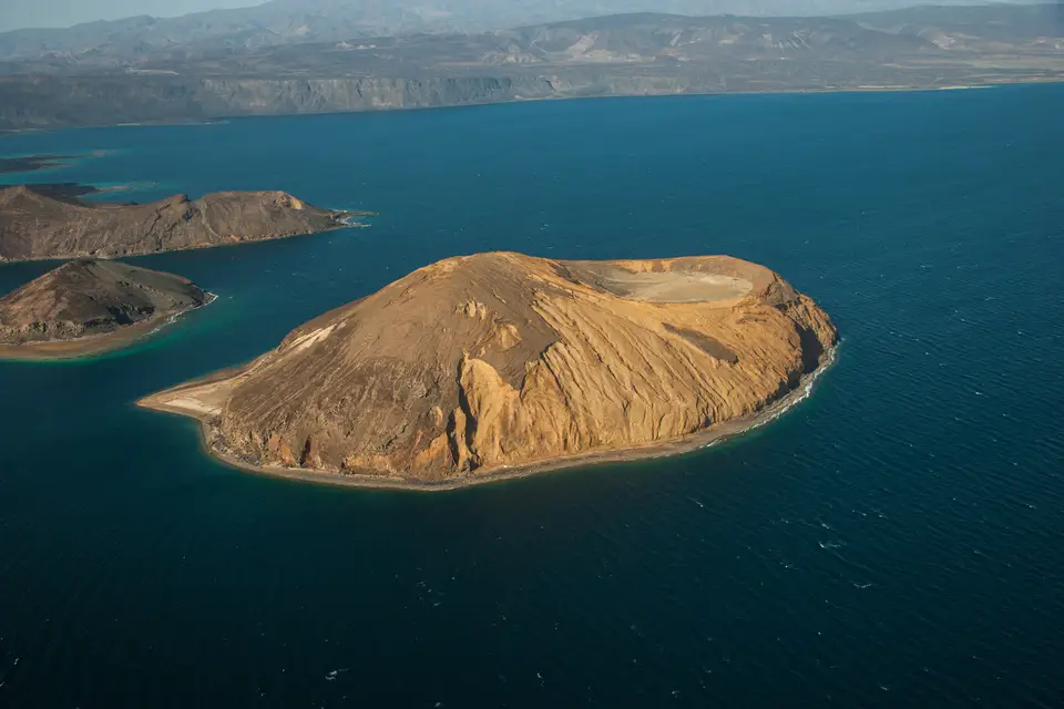
The Goubet al-Kharab is a deep cove of the Gulf of Aden, in the Tadjourah region, separated from the Gulf of Tadjoura by a channel with a violent current. The Dalmar catalogue and the Wikipedia article on the Ghoubbet describe it as bordered by cliffs 600 metres high, 200 metres deep, and holding two volcanic islets called the Devil's islands. The Ardoukoba volcano separates it from Lake Assal.
The spelling retained is “Goubet al-Kharab”. The place is also written Ghoubbet el-Kharab, Goubbet al-Kharab or Goubet El Kharab depending on the source. It is the same place: a cove closed by a narrow channel, between the Gulf of Tadjoura and the corridor leading to Lake Assal.
What is the Goubet al-Kharab?
The Goubet al-Kharab is a cove of the Gulf of Aden, in the Tadjourah region, closed in on itself by a narrow channel with a violent current. It is that channel which separates it from the Gulf of Tadjoura, and which gives the place its character: an inland, enclosed sea, where water moves fast.
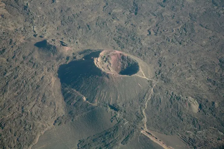
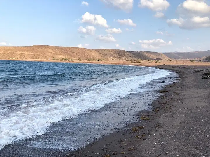
The Dalmar catalogue attributes a tectonic origin to the cove: a collapse of the earth’s crust. The landscape matches — black or tawny rocks, frozen lava, peaks, outlines of former craters, and rare patches of green clinging to the relief.
Around it, mountains and cliffs close the horizon. The catalogue and the article on the Ghoubbet put them at 600 metres high; the cove itself is described as 200 metres deep, with walls plunging straight into the sea.
A geographical clarification, because both readings circulate. The article on the Gulf of Tadjoura includes the Ghoubbet in its western part, and recalls that the gulf was itself born from the opening of the East African rift. The article on the Ghoubbet insists, for its part, on the channel that isolates it. The two descriptions do not contradict each other: they describe the same bay at two scales — the end of a gulf, and a body of water that its narrow mouth makes almost autonomous.
Why is it called the “gulf of Demons”?
The name is a translation from Arabic: Goubet al-Kharab, the gulf of Demons. Two accounts overlap.
The first is a story of jinn. Djiboutians tell that supernatural creatures, able to take varied forms, draw in those who approach the islands. The second account, reported by the catalogue in its description of the beach, tells of a great mountain crowned with fire, swallowed by the waters, leaving behind a gulf in which the demons remained imprisoned.
These accounts are not geological data, and nobody presents them as such. They do explain why the place has remained, in the local imagination, a place apart — a place where you do not linger after sunset.
| Reference | Data | Origin |
|---|---|---|
| Nature of the site | Cove of the Gulf of Aden, closed by a narrow channel | Catalogue and article on the Ghoubbet |
| Cliffs | 600 m high | Catalogue and article on the Ghoubbet |
| Depth of the cove | 200 m | Catalogue and article on the Ghoubbet |
| Islands | Two volcanic islets, known as the Devil’s islands | Catalogue and article on the Ghoubbet |
| Announced origin | Collapse of the earth’s crust | Catalogue |
| Neighbourhood | The Ardoukoba volcano separates it from Lake Assal | Catalogue and article on the Ghoubbet |
| Level difference | Up to 1 m with sea level, depending on tides and winds | Article on the Ghoubbet |
| Region | Tadjourah | Catalogue |
What are the Devil’s islands?
In the middle of the cove emerge two volcanic islets, with rounded shapes and modest altitude. These are the Devil’s islands. Their dome silhouette is one of the most reproduced images of Djibouti.
The catalogue notes, on those islets, oyster shells and the tools used to open them, dated to more than 6,000 years according to those data. That is an archaeological indication of the first importance — it suggests an ancient use of the site — and we report it as a catalogue datum, without being able to cross-check it against an accessible publication.
So plan to look, not to dig. A site of this nature is visited without taking anything.
Why is the current so violent?
It all comes down to the geometry of the place. The cove is almost closed: water enters and leaves only through a narrow channel. At every tide, a considerable volume of water has to pass through a reduced mouth, which accelerates the flow.
The article on the Ghoubbet adds a measurable effect: the cove can show up to a metre of difference with sea level, because of the narrowness of the channel, the tides and the winds.
Practical consequence: the current is not constant. It strengthens and weakens with the tide, and it can turn an easy site into a difficult one within a few hours. That is precisely what attracted divers and scientists here — Commander Cousteau is cited by the catalogue as one of the site’s visitors — and it is also what makes supervised diving essential.
What can you do in the Goubet al-Kharab?
The catalogue cites several uses: fishing, kitesurfing, snorkelling and scuba diving. The article on the Ghoubbet specifies that the richness of the waters attracts fishermen from the city of Djibouti, and that the seabed holds fish and sharks, driven by the currents of the gulf.
For diving, the cove combines naturally with the rest of the Tadjourah coastline. Our page on diving in Djibouti describes the country’s sites and the levels required.
On land, the cove is discovered from the heights. The viewpoint overlooking it is a classic stop on the route to Lake Assal, and the Ardoukoba volcano, just beside it, can be visited the same day.
Where is the Goubet and how do you reach it?
The cove occupies the inner end of the Gulf of Tadjoura, in the Tadjourah region. It belongs to a remarkable geological corridor, between the Ardoukoba volcano that separates it from Lake Assal and the road linking Tadjourah to the rest of the country.
Two accesses coexist. By road, you discover the cove from above: the viewpoint offers the view over the Devil’s islands and the cliffs. By sea, you discover it from inside: boat, fishing, snorkelling. A camp allows you to sleep on site, which avoids heading back in the afternoon heat.
We publish no journey time: it depends on the departure point, the state of the track and the stops. For logistics, see 4×4 rental with driver and our page on camps and ecolodges.
What should you know before going?
- The current is not negotiable. Swimming and snorkelling in the calm areas only; supervised diving for the channel and exposed sites.
- There is no bathing supervision and no organised rescue on site. Nobody will come looking for you.
- Bring plenty of water and sun protection: the site is mineral, without shade, and reflection off the water is strong.
- The wind gets up quickly. A boat trip can be cut short or cancelled without notice.
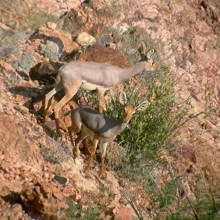
- No wildlife sighting is guaranteed, neither the sharks nor the whale sharks reported in the sector.
- Take nothing from the islets, shells included: they are remains, not souvenirs.
Frequently asked questions
Why is the Goubet al-Kharab called the gulf of Demons?
The name comes from Arabic: Goubet al-Kharab means 'the gulf of Demons'. Two accounts circulate. The catalogue reports legends of demons that draw in those who approach the islands, and of jinn able to take any form. Another version tells of a mountain crowned with fire, swallowed by the waters, whose demons were left imprisoned. None of it is verifiable: it is oral heritage.
Can you swim in the Goubet al-Kharab?
Swimming is practised in the calm areas, on the beach side, and not in the channel, where the current is violent. The catalogue describes a fine sand beach bordered by turquoise water, which corresponds to the sheltered parts of the cove. Stay cautious: there is no established supervision, the water is deep close to the shore and the current can take you by surprise. A mask and snorkel are enough to enjoy the seabed.
How deep is the Goubet al-Kharab?
The cove reaches 200 metres deep according to the Dalmar catalogue, a figure the article on the Ghoubbet confirms. Its rocky walls plunge straight into the sea, without an extended coastal shelf. That depth, combined with the passage of currents, explains the presence of fish and sharks in the cove. Depth is not a diving datum: it situates the site, it does not describe a trip.
Are the Devil's islands accessible?
Two volcanic islets emerge in the middle of the cove: these are the Devil's islands, with rounded shapes and modest altitude. The catalogue mentions, on the islets, oyster shells and the tools used to open them, dated to more than 6,000 years according to those same data. Access is by boat and depends on the current. We hold no information on landing conditions.
Do you need a boat to visit the Goubet al-Kharab?
No, the cove can also be discovered from the road overlooking it: the catalogue and our page on Lake Assal point to a viewpoint, on the route leading to the lake. A boat remains necessary to approach the Devil's islands, for snorkelling and for fishing. Allow a suitable vehicle if you leave the tarmac: the track requires a 4×4.
Sources
Location
Lat. 11.52529Lng. 42.60053
Destinations
Read next
Abourma: the rock engravings of the Makarrassou massif
Ali-Sabieh: the south-east region, sites and camps
Allols depression: salt, hot springs and caravans
Ardoukoba: the most recent volcano in Djibouti
Arta: the cool of the interior and whale sharks
Assamo: the protected area of the beira antelope
Balho: rock art and the northern border post
Bankoualé: the oasis at the foot of the Goda massif