Ardoukoba: the most recent volcano in Djibouti
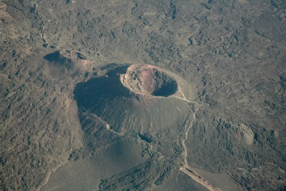
Ardoukoba is a volcano in Djibouti born from a fissure eruption in November 1978, in the Tadjourah region, between Goubet al-Kharab and Lake Assal. It belongs to the Asal-Ghoubbet rift, where the earth's crust is pulling apart, which makes it an object of study as much as a site to visit. The Dalmar catalogue describes a walk around the crater of about four hours, to be done in the cool season.
On the date of birth. The Dalmar catalogue dates the eruption to November 1978 in its Ardoukoba factsheet, and its entry on the rift even specifies 8 November 1978. The Wikipedia article on Ardoukôba confirms that the volcano “appeared in 1978”, and the scientific literature describes a rifting episode in November 1978 in the Asal-Ghoubbet rift. We therefore publish the year: it is sourced three times.
What is the Ardoukoba volcano?
Ardoukoba is a small volcano in the Tadjourah region, set between Goubet al-Kharab and Lake Assal. Its peculiarity is not its size, it is its age: it was born from an eruption in November 1978, which makes it one of the most recent volcanoes on the planet.
It belongs to the Asal-Ghoubbet rift, a segment where two plates are pulling apart. The catalogue presents it as a privileged observation site for geologists, with a visible fault that can be followed on foot, “as in Iceland”, and a black, shining, tormented lava descended between Ardoukôba and the Goubet.
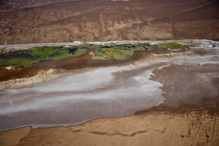
This is not a postcard volcano. No regular cone, no plume, no visitor centre. It is a low, jagged relief, in a landscape of black basalt and white evaporites, where you walk on the rock.
When was Ardoukoba born?
The episode is dated and documented. The catalogue gives its chronology in its entry on the rift: on 8 November 1978, after more than eight hundred precursor earthquakes, enormous fractures opened, stretching the whole rift by one and a half metres and lowering its floor by nearly a metre. One of those fractures sank deeply enough to reach a pocket of magma stored a few hundred metres below ground — and the lava burst out, creating a volcano.
| Reference | Data | Origin |
|---|---|---|
| Birth | November 1978, fissure eruption | Catalogue, Wikipedia, scientific literature |
| Precise date announced | 8 November 1978 | Catalogue |
| Precursor earthquakes | More than 800, according to the catalogue | Catalogue |
| Stretching of the rift | 1.50 m in one event | Catalogue |
| Lowering of the floor | Nearly 1 m | Catalogue |
| Temperature of the lava fountains | 1,100 °C | Catalogue |
| Position | Between Goubet al-Kharab and Lake Assal | Catalogue and Wikipedia article |
| Access | Track; 4×4 indicated by the catalogue | Catalogue |
| Walk around the volcano | About 4 hours, to be done in winter | Catalogue |
The figures in this table come from the Dalmar catalogue, except the date of birth, cross-checked with the Wikipedia article and the scientific literature. We do not present them as measurements we made ourselves.
Where is the Ardoukoba volcano?
The volcano occupies the floor of the depression, between the Goubet cove to the east and Lake Assal to the west. That position is no accident: it was born precisely where the rift opens, in the corridor linking the two basins. The catalogue places its address between “Goubet” and “Assal”, which sums up the geography well.
Access is by the track crossing this sector. The catalogue describes the route as follows: a track heading off to the left and climbing into the mountain after Dankalélo, with a 4×4 required, up to a point called the “Belvédère”; the track then comes down to the “Carrefour du Volcan”, from where you continue on foot to the Ardoukôba rampart.
We publish neither distance nor road journey time: they depend on the departure point and the state of the track. For the vehicle, see 4×4 rental with driver.
How do you walk around the volcano?
The catalogue announces about four hours of walking to go around the volcano, and specifies that this hike is done in winter — meaning the cool season, not the calendar sense strictly.
The principle is simple: you park at the crossroads, reach the rampart on foot, and you can go around the crater to the right to look inside. The ground is made of lava blocks and scoria, uneven and sharp: bring closed shoes with thick soles, not sandals.
That figure of four hours is a catalogue indication. It assumes a group that keeps moving, normal weather and few stops. Allow more if you are photographing, and much more if the heat has set in.
What is the best period to go up to Ardoukoba?
The catalogue recommends winter for the walk. That is consistent with the geography: the volcano sits in the hottest depression in the country, a stone’s throw from Lake Assal, where our page on Lake Assal describes a basin that works like an oven in summer.
The logic is therefore the same as for the whole sector: set off early, walk in the morning, come down before the heat settles, and carry far more water than planned. To place the seasons, see when to go to Djibouti.
What is there to see around Ardoukoba?
Three groups combine on site.
First the lava fields from the eruption, which the catalogue describes as a black, shining expanse crossed by cracks, small chasms and tunnels. Our page on the rift and lava fields details what can be observed there.
Then the Great Fault, whose line the catalogue places from Lake Assal to Baddi Kôma, and which ends in a fan at the lake.
Finally Goubet al-Kharab, to the east, with its cliffs and its Devil’s islands. The three sites are visited in the same day, which explains why the volcano is often a stage rather than a destination.
What precautions should you take on site?
- No water point, no shade, no supplies. Everything you need must be in the vehicle.
- The 4×4 is indicated by the catalogue for the access track: do not set off in a saloon car, even in dry weather.
- The ground is lava. Sharp blocks, rolling scoria, cracks: falls are the site’s first real risk.
- Do not enter the lava tunnels alone, as described by the catalogue; they are unstable and unlit.
- Take no lava and do not move the blocks: the site is an object of study as much as a landscape.
- Tell someone your itinerary before setting off on the track.
Frequently asked questions
Is the Ardoukoba volcano still active?
Ardoukoba belongs to the Asal-Ghoubbet rift, a system where the earth's crust is still pulling apart, and it was born from an eruption in November 1978. We publish no current activity status: it is not data we hold, and a volcano is not summed up by its last eruption. On site, the catalogue reports no restriction linked to volcanic risk.
Why does Ardoukoba interest geologists?
Because you read the movements of the earth's crust there directly. The catalogue describes a clearly visible fault that can be followed on foot, and a volcano created before our eyes on a human timescale: a documented eruption in 1978, in an active rift. The volcanologist Haroun Tazieff is cited among the specialists who came to observe the site. For a geologist, it is an accessible textbook case.
Do you need a 4×4 to reach the Ardoukoba volcano?
The catalogue states that a 4×4 is necessary: the track leading to the viewpoint climbs into the mountain after Dankalélo, and the rest of the route remains track. A saloon car is not enough. If you are not driving yourself, 4×4 rental with a driver is the usual formula for this sector, and it is booked in advance.
How long does the walk around the volcano take?
The catalogue announces about four hours of walking to go around the volcano, and specifies that this hike is done in winter. We repeat that figure as a catalogue indication, not as a guarantee: the real time depends on your pace, the heat and the time spent observing the crater. Set off early in the morning.
What do you see from the Ardoukoba volcano?
Black, chaotic lava flows, descended between Ardoukôba and the Goubet during the 1978 eruption. The catalogue describes a shining, tormented lava that contrasts with the pale evaporites of Lake Assal. You also make out the volcano's rampart and, by going around the crater to the right, its interior. The panorama takes in the rift, the lava fields and the lake.
Sources
Location
Lat. 11.61110Lng. 42.47575
Destinations
Read next
Abourma: the rock engravings of the Makarrassou massif
Ali-Sabieh: the south-east region, sites and camps
Allols depression: salt, hot springs and caravans
Arta: the cool of the interior and whale sharks
Assamo: the protected area of the beira antelope
Balho: rock art and the northern border post
Bankoualé: the oasis at the foot of the Goda massif
Daasbiyo cave: rock paintings and burial mounds