Rift and lava fields: walking on the Assal fault
The Djibouti rift is the great fault that marks, in the Tadjourah region, the boundary between the Arabian and African plates. The Dalmar catalogue describes a tear more than five kilometres long, with a vertical throw reaching five metres in places, and a lava field of twenty square kilometres between the Hâhayta Kôma dome and Lake Assal. The Ardoukoba volcano was born there in November 1978.
The figures on this page are those of the Dalmar catalogue. Length of the fault, vertical throw, surface of the lava field, scale of the 1978 episode: these values come from catalogue data, taken as they stand. They describe a site, not a stroll: no waymarked path, no shade, no supplies.
What are the Djibouti rift and lava fields?
The rift is the scar that crosses the country. In the Tadjourah region, the floor of the Assal rift is bounded by a system of faults, and one of them is marked enough to carry a name: the Great Fault of Djibouti.
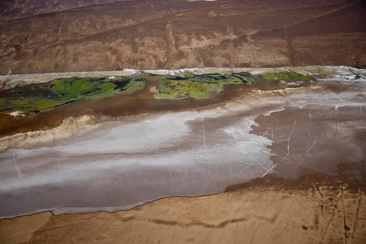
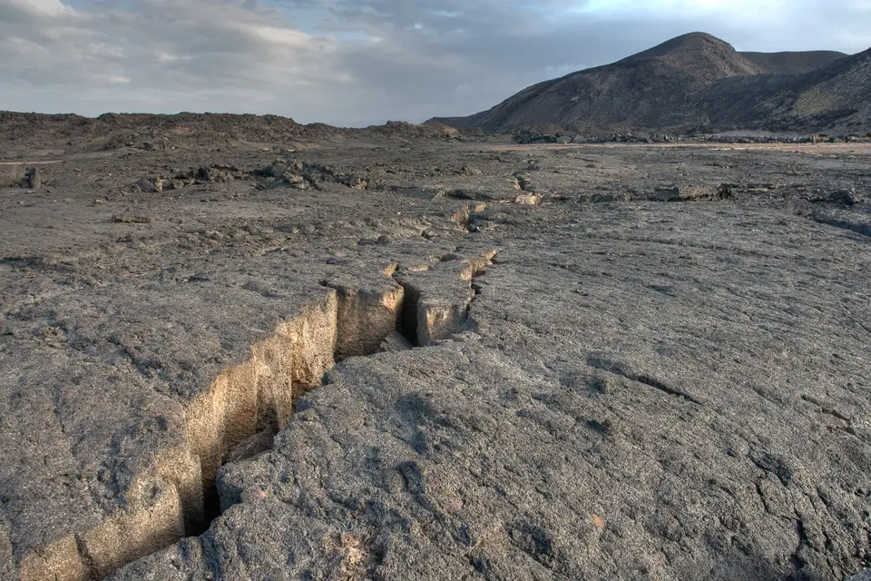
The catalogue describes it as a tear more than five kilometres long, with a vertical throw reaching five metres in places, ending in a fan at Lake Assal. The fault system borders the axial floor of the depression to the south, from Lake Assal to Baddi Kôma, passing through the Belvédère.
The lava fields are what covers that floor: the catalogue describes recent basaltic flows forming a lava field of 20 km² between the Hâhayta Kôma dome and Lake Assal. The most recent flows cover evaporite deposits 2,000 years old, and the fissures crossing them are visible to the naked eye.
What do you see on the Great Fault?
Three things, in the order you meet them.
First the throw: the vertical offset between the two lips of the fault. It reaches five metres in places according to the catalogue, which is enough to read the movement at human height.
Then the walls. The catalogue notes that they are often covered in limestone of hydrothermal origin, a clue arguing for a subaquatic, lacustrine origin: in other words, what lies before your eyes was deposited underwater, in a lake that then occupied the depression.
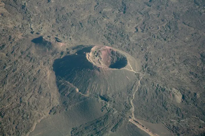
Finally the overall geometry: the fault opens out in a fan towards Lake Assal, and the floor of the depression is punctuated by black and rust-coloured craters, signs of very young volcanism.
What happened on 8 November 1978?
This is the episode that put this rift on the map. The catalogue gives its chronology, and the scientific literature makes it a textbook case of continental rifting.
On 8 November 1978, after more than eight hundred precursor earthquakes, enormous fractures opened. The rift stretched at once by one and a half metres, and its floor dropped by nearly a metre. One of the fractures sank deeply enough to reach a pocket of magma stored a few hundred metres below ground. The lava burst out, creating a new volcano — Ardoukoba — and threw up lava fountains at 1,100 °C.
| Reference | Data from the Dalmar catalogue |
|---|---|
| Length of the main tear | More than 5 km |
| Vertical throw | Up to 5 m in places |
| Lava field | 20 km², between the Hâhayta Kôma dome and Lake Assal |
| Age of the deposits covered by the recent flows | 2,000 years |
| Precursor earthquakes, November 1978 | More than 800 |
| Stretching of the rift in 1978 | 1.50 m |
| Lowering of the floor in 1978 | Nearly 1 m |
| Temperature of the lava fountains | 1,100 °C |
We repeat these values without transforming them. They come from a catalogue, not from a measurement campaign we carried out — but the November 1978 episode in the Asal-Ghoubbet rift is indeed well documented by the scientific literature.
What do the lava fields look like?
Like a black, shining expanse. The catalogue describes a thick, textured solidified lava, full of frozen movements, crossed by faults and fissures. The eye loses itself quickly: everything is black, everything looks alike, and visual landmarks are lacking.
The lava field is not smooth. It is dotted with small chasms and tunnels, remnants of flows that froze at the surface while the interior kept flowing. There is life there too: succulent plants and a few flat shrubs make their way through the rock, and the catalogue mentions goats and camels grazing across the flows.
From the heights, the view takes in the 1978 flows, the Great Fault, the Manda basalt field and Lake Assal. It is that panorama which gives the site its meaning: you read the opening of a continent at a single glance.
How do you visit the rift and the lava fields?
The sector is crossed by 4×4 and, preferably, with a local guide. This is not a precaution of principle: the catalogue describes terrain without a path, where faults and fissures are sometimes barely visible, and where a companion knows where to put your foot.
The site combines naturally with three immediate neighbours: Lake Assal, the Ardoukoba volcano and Goubet al-Kharab. One day is generally enough to see two of them, rarely three.
For logistics, see 4×4 rental with driver and when to go to Djibouti to choose your window. We publish neither distance nor journey time: they depend on the departure point and the state of the tracks.
What should you know before walking on the fault?
- There is no shade, no water and no rescue on site. Set off self-sufficient.
- Do not enter the tunnels and chasms described by the catalogue: the ground is unstable and the darkness total.
- Watch out for lava blocks. The rock is sharp and the scoria rolls underfoot; that is the first cause of injury on this kind of terrain.
- Stay on visible tracks if you are walking without a guide.
- Tell someone your itinerary before leaving the tarmac.
- Take no samples and do not move the blocks: the site is studied, and what you see has been in place since 1978.
- Leave with all your waste. The sector has no collection.
Frequently asked questions
Can you walk on the fault between the Arabian and African plates?
Yes, and that is the main interest of the site: the catalogue describes a fine line separating the Arabian and African plates, which can be followed on foot through the lava fields. You have to understand what you are looking at: the boundary between two plates is not a line cut into the ground, it is a zone of fractures, tens of metres wide in places. A local guide helps read the terrain.
Where is the Great Fault of Djibouti?
In the Tadjourah region, on the floor of the Assal rift. The catalogue places its line from Lake Assal to Baddi Kôma, passing through the Belvédère, and describes a system of faults bordering the axial floor of the depression to the south. The main tear, more than five kilometres long according to those data, ends in a fan at Lake Assal.
Will the Djibouti rift become an ocean?
That is the hypothesis the catalogue describes, and it is consistent with the geology of the sector. The article on the Gulf of Tadjoura also recalls that the gulf was born from the opening of the East African rift. On a human timescale, nothing moves perceptibly, except during brutal episodes such as November 1978. The landscapes you see are therefore an open building site, not a fixed relief.
Can you visit the lava fields without a guide?
We do not recommend it. The catalogue mentions a guide who shows the faults and fissures, and the terrain lends itself poorly to improvisation: chaotic lava, small chasms, tunnels, no landmarks and no waymarked path. A local guide also knows where the ground is stable. If you go alone, stay on visible tracks and do not enter the cavities.
What is the best period to visit the rift?
The cool season. The rift occupies the floor of a depression, between Lake Assal and the Goubet, and the catalogue explicitly recommends winter for walking on the neighbouring volcano. The principle holds for the whole sector: set off early in the morning, walk before the heat settles, and leave the site before midday. No shade is available on site.
Sources
Location
Lat. 11.59781Lng. 42.51840
Destinations
Read next
Abourma: the rock engravings of the Makarrassou massif
Ali-Sabieh: the south-east region, sites and camps
Allols depression: salt, hot springs and caravans
Ardoukoba: the most recent volcano in Djibouti
Arta: the cool of the interior and whale sharks
Assamo: the protected area of the beira antelope
Balho: rock art and the northern border post
Bankoualé: the oasis at the foot of the Goda massif