Ras Siyan: the volcanic peninsula of the Obock region
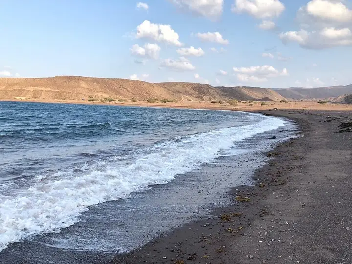
Ras Siyan is a peninsula in the Obock region, on the Bab el-Mandeb strait, about twenty kilometres south-west of Perim island. It consists of a reddish volcanic hill 138 metres high, linked to the mainland by a sandy spit, and a shallow bay bordered by mangrove and seagrass beds. The cape is sometimes counted as the seventh of the Seven Brothers islands, whose marine protected area bears the name.
Where is Ras Siyan?
Ras Siyan is a peninsula in the Obock region, on the Bab el-Mandeb strait — the meeting point between the Red Sea and the Gulf of Aden, at the southern entrance to the Red Sea. It lies about twenty kilometres south-west of Perim island.
A word on the name. This place is spelt in several ways depending on the source: Ras Siyan (our spelling, aligned with this page’s address), Ras Siyyan in the official designation of the Unesco biosphere reserve, and Ras Syan in the Dalmar catalogue. It is the same cape, and if you are looking for a trip, it is under those different spellings that you will find it.
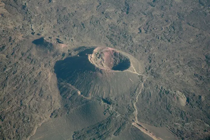
Its shape explains everything else. Ras Siyan is not an island: it is a reddish volcanic hill, about 1.2 kilometres long and 500 metres wide, peaking at 138 metres, which a low sand spit links to the mainland. That spit stretches south for about five kilometres, widening from 500 to 800 metres.
The Dalmar catalogue ties this area to the record for the Seven Brothers marine protected area, whose address carries the mention “Ras Syan” and the Obock region.
What can you see on the peninsula?
Three environments overlap in a very small space.
The volcanic hill. Reddish, it dominates the strait. The volcano is inactive, but young: it is described as having pierced a coral formation 21,000 years old, which gives the whole an unusual profile.
The sand spit. This is the tongue of sand attaching the cape to the mainland. The National Tourism Agency describes a fine sand beach two kilometres long there, frequented by turtles and crustaceans, and a seabed that forms, with the mangrove, a nursery where many fish species concentrate.
The bay and its mangrove. West of the cape opens a shallow marshy bay, about 2.5 kilometres wide, protected to the north by coral banks. It is bordered by white mangroves (Avicennia marina) and abundant seagrass beds, notably of the genera Halodule and Thalassia. An isolated white rock, Siyyan Rock, stands in the bay about 800 metres south-west of the hill.
| Reference | Data | Source |
|---|---|---|
| Region | Obock | Dalmar catalogue |
| Location | Bab el-Mandeb strait, about 20 km south-west of Perim island | Wikipedia (en) |
| Relief | Reddish volcanic hill about 1.2 × 0.5 km | Wikipedia (en) |
| High point | About 138 m | Wikipedia (en) |
| Link to the mainland | Sand spit about 5 km long | Wikipedia (en) |
| Bay | About 2.5 km wide, protected by coral banks | Wikipedia (en) |
| Vegetation | Mangrove of Avicennia marina, beds of Halodule and Thalassia | Wikipedia (en) |
| Beach | Fine sand over about 2 km | ANT |
| Marine protected area | 447.1 km², or about 27% of the country’s coastal fringe | Dalmar catalogue |
Is the cape part of the Seven Brothers?
Yes, in toponymy at least. The cape’s hill is sometimes counted as the seventh brother of the archipelago, the six other islands lying 4.5 to 14.5 kilometres to the east. That explains the name of the sector’s marine protected area.
That marine protected area is documented in the Dalmar catalogue as covering 447.1 km², or about 27% of the country’s coastal fringe. It holds natural coral reefs, seagrass beds and preserved mangroves, in a shallow marine zone where hydrodynamic conditions have favoured a rare biodiversity: sharks, sea turtles, dugongs and migratory birds.
The page Seven Brothers archipelago details the islands themselves and their dive sites; Ras Siyan is their landward endpoint.
Why is this sector important for biodiversity?
Because it adds together environments rarely found side by side: reefs, seagrass beds, mangroves and coastal desert. Unesco’s Man and the Biosphere programme designated the whole “Seven Brothers archipelago – Ras Siyyan – Khor Angar – Godoria” as a biosphere reserve in 2025.
The figures published by Unesco give the measure of the site: 272,160 hectares in total, of which 197,574 hectares marine and 74,576 hectares terrestrial, with more than 970 species recorded, 12 marine mammals, more than 520 reef fish species and 238 coral species, of which 32 threatened. The mangroves of Ras Siyan, Khor Angar and Godoria are described as the largest and most diversified in the country.
The sector is also one of the world’s most important raptor migration corridors: between 85,000 and 245,000 birds of prey pass through each year. The emblematic species cited are the dugong, the whale shark and the sooty falcon.
A detail useful to anyone interested in wildlife: sharks breed in the bay of Ras Siyan, where they are reported in October. The area also supports communities of Afar fishermen and herders, between small-scale fishing, pastoralism, date palm cultivation and salt gathering.
How do you visit Ras Siyan?
The cape is discovered from the sea, as part of boat trips organised in the Seven Brothers sector: diving, snorkelling, wildlife watching. The sources consulted describe no road access to the peninsula, and no visitor structure on site.
Three practical points before setting off:
- This is the end of the world, not an equipped beach. Nothing is described on site: bring your water, your food and something to shelter from sun and wind.
- The bay is shallow and the mangrove fragile. Do not cut mangroves, do not stir up the sediment, throw nothing from the boat.
- Keep your distance from the wildlife. Turtles, dugongs and sharks are not to be chased, and the bay serves as a nursery for many species.
The sector combines naturally with the town of Obock and the Godoria mangrove, and with a day of diving in Djibouti for those who come for the seabed.
What is the best period to go?
The most comfortable window runs from November to March, when the north coast is ventilated and the sea generally calm. From May to September, heat and wind make trips gruelling, and wildlife watching loses its interest in the hot hours.
To set your dates, the page when to go to Djibouti gives the month-by-month detail. If you are aiming for whale sharks rather than the cape, note that the season for that species is shorter and does not coincide exactly with the climatic window: the page diving with whale sharks details that calendar.
Frequently asked questions
Where is Ras Siyan?
In the Obock region, at the northern tip of the Djiboutian coast, on the Bab el-Mandeb strait separating the Red Sea from the Gulf of Aden. The peninsula lies about twenty kilometres south-west of Perim island. It is linked to the mainland by a low sand spit, about five kilometres long and five hundred to eight hundred metres wide.
Is Ras Siyan part of the Seven Brothers islands?
The cape's hill is sometimes considered the seventh brother: the six other islands of the archipelago, or Sawabi, lie from four and a half to fourteen and a half kilometres to the east. That explains why the sector's marine protected area bears the name of the Seven Brothers even though it also takes in the peninsula and the neighbouring mangroves.
What can you see at Ras Siyan?
A reddish volcanic hill of about 138 metres, a sand spit attaching it to the mainland, and to the west a shallow bay two and a half kilometres wide, bordered by mangroves and seagrass beds. The National Tourism Agency describes a fine sand beach two kilometres long. An isolated white rock, Siyyan Rock, stands in the bay.
How do you visit Ras Siyan?
The cape is discovered from the sea, as part of boat trips organised in the Seven Brothers sector. The sources consulted describe no road access to the peninsula, and no visitor structure on site. So plan for water, strong sun protection and something to shelter behind: natural shade is scarce and the site is far from any help.
Why is this sector protected?
Because it brings together remarkable marine environments. Ras Siyan, Khor Angar and Godoria form the three largest and most diversified mangrove systems in the country, and the whole was designated a biosphere reserve in 2025, with more than 272,000 hectares of which nearly 198,000 hectares marine. Dugongs, whale sharks and four threatened sea turtle species are found there.
Sources
Destinations
Read next
Abourma: the rock engravings of the Makarrassou massif
Ali-Sabieh: the south-east region, sites and camps
Allols depression: salt, hot springs and caravans
Ardoukoba: the most recent volcano in Djibouti
Arta: the cool of the interior and whale sharks
Assamo: the protected area of the beira antelope
Balho: rock art and the northern border post
Bankoualé: the oasis at the foot of the Goda massif